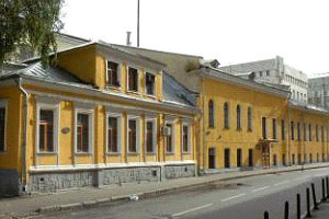
Institute of Geography, Russian Academy of Sciences is the oldest (founded in 1918) and the largest Russian research center in physical and economical geography. The main present-day research directions are: evolution of natural environment and surface natural resources; natural cryogenic systems; dynamics of the processes of cryosphere; geographical problems of land use and nature conservation; interaction between environment and society in terms of rising anthropogenic pressure; regional frameworks for sustainable development of environment and society; GIS technologies and mapping.
RECENT ACHIEVEMENTS:
- Unique geographical atlases “Nature and Resources of the Earth”, “Atlas of Snow-Ice Resources of the World” were created.
- The assessment criteria for the environmental situation were developed, more than 30 environmental maps of different scale for certain countries of the CIS and regions of Russia, as well as the maps of natural and industrial catastrophes.
- Climatic history for four cycles (420ka) was reconstructed based on Antarctic ice core.
- Scenarios of changes of nature zones and landscapes of the northern hemisphere and Russia under global warming were developed.
- Concepts, methods, programs and technologies of GIS and electronic mapping were developed and implemented.
- Patterns of shifts of the territorial structure of economy and society of Russia were revealed; recommendations on the optimization were made.
- Methods suggested and assessment made for economic and environmental reliability of regional land use systems in Russia.
Besides fundamental research the Institute is involved in development of theoretical methods for practical application. Employees of the IGRAS were widely involved I n preparation of legislation on nature conservation and environmental survey. First maps of the state of environment of USSR, Russia and several countries of the CIS were created here. On the basis of agreements between Russian government and UNEP, EC, World Bank the Institute has carried out environment impact assessment, environmental audit and developed measures of minimization of negative impacts of economy. Employees of the Institute are often involved in the activities of the State Environmental Approval.
The Institute carries out specialized works on GIS-mapping and satellite monitoring. All the major GIS-systems are implemented here, as well as the originally developed GIS`s that are used by the Russian government and the Emergency Control Ministry.
IGRAS is highly focused on staff preparation and education. Many of the heads of geography-specialized organizations in the CIS and Eastern Europe had their postgraduate course in the Institute of Geography. At the moment the Institute annually hosts 40-50 PhD students, about 50 trainees and 2-4 working for doctor`s degree. IGRAS has four specialized councils for defending the doctor`s thesis.
The Institute publishes three academic journals on geography, geomorphology and glaciology.


